Course characteristics
Difficulty scale
RMT
7
Mountain value
G
3
Class group

Ultra
Mountain value group
G
Flat
Distance
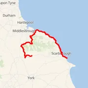
⨦ 173.5 km
Flat equivalent
Uphill
+ 4 650 m
Downhill
- 4 600 m
Location
Filey, United Kingdom
Time predictions
Check your potential! Estimate your finish time, see if you can run the course in a certain time, or maybe you'll compete for the win?
Check nowElevation profile
Highest point
449 m a.s.l.
Lowest point
0 m a.s.l.
Elevation range
449 m
Castle Hill ~ 0 m a.s.l.
⨦ 14 km
Highcliffe ~ 0 m a.s.l.
⨦ 94.5 km
Little Roseberry ~ 0 m a.s.l.
⨦ 98 km
Roseberry Topping ~ 322 m a.s.l.
⨦ 98.5 km
Roseberry Topping ~ 322 m a.s.l.
⨦ 98.5 km
Little Roseberry ~ 0 m a.s.l.
⨦ 99.5 km
Round Hill ~ 454 m a.s.l.
⨦ 117.5 km
White Hill ~ 398 m a.s.l.
⨦ 121 km
Carlton Bank ~ 408 m a.s.l.
⨦ 126.5 km
Beacon Hill ~ 299 m a.s.l.
⨦ 135 km
Course information
Elevation data
Copernicus DEM 30 m
Number of events with this course
1
Event date
29 May 2021
Results published
6 Jun 2021
Valuation status
Results during the 2021 edition
Men


Women


Course statistics
Join to discover more!
Check your run history, analyze your achievements, and compare results with other runners.
Log in nowCourse variant code V-180 – this code is used to group course records in this event.

Your effort has a color
Amator
Beginner Level
Advanced Level
Expert Level
Elite
Rate My Trail © 2018 / 2026
Mountain Runners Ranking