
Course characteristics
Difficulty scale
RMT
6
Mountain value
G
3
Class group

Ultra
Mountain value group
G
Flat
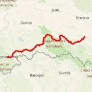
Distance
⨦ 101.5 km
Flat equivalent
Uphill
+ 3 450 m
Downhill
- 3 400 m
Time predictions
Check your potential! Estimate your finish time, see if you can run the course in a certain time, or maybe you'll compete for the win?
Check nowElevation profile
Highest point
849 m a.s.l.
Lowest point
381 m a.s.l.
Elevation range
468 m
Lipki ~ 472 m a.s.l.
⨦ 5 km
Cergowa ~ 716 m a.s.l.
⨦ 8.5 km
Kaput Waldu ~ 684 m a.s.l.
⨦ 15.5 km
Piotruś ~ 728 m a.s.l.
⨦ 16 km
Ostra ~ 687 m a.s.l.
⨦ 21 km
Czerwony Horb ~ 616 m a.s.l.
⨦ 22.5 km
Tokarnia ~ 693 m a.s.l.
⨦ 25 km
Jasieniki ~ 0 m a.s.l.
⨦ 35.5 km
Łan ~ 0 m a.s.l.
⨦ 39.5 km
Kanasiówka ~ 831 m a.s.l.
⨦ 47.5 km
Góra Polańska ~ 737 m a.s.l.
⨦ 64 km
Putyska ~ 647 m a.s.l.
⨦ 67.5 km
Skibce ~ 776 m a.s.l.
⨦ 77.5 km
Zrubań ~ 0 m a.s.l.
⨦ 78 km
Wilcze Budy ~ 0 m a.s.l.
⨦ 82.5 km
Szachowo ~ 0 m a.s.l.
⨦ 83.5 km
Tokarnia ~ 778 m a.s.l.
⨦ 85.5 km
Wierch Mendla ~ 0 m a.s.l.
⨦ 86.5 km
Golowa ~ 0 m a.s.l.
⨦ 87.5 km
Kremenec ~ 0 m a.s.l.
⨦ 89 km
Poruby ~ 0 m a.s.l.
⨦ 90.5 km
Ruda ~ 701 m a.s.l.
⨦ 91 km
Wahalowski Wierch ~ 666 m a.s.l.
⨦ 95.5 km
Course information
Elevation data
SRTM DEM 30 m
Number of events with this course
5
Event date
21 Oct 2023
Results published
22 Oct 2023
Valuation status
Results during the 2023 edition
Men


Anonymous
Profile
10g 17m 28s
+ 20m 31s

Women


Course statistics
Join to discover more!
Check your run history, analyze your achievements, and compare results with other runners.
Log in nowCourse variant code V-100 – this code is used to group course records in this event.
Your effort has a color
Amator
Beginner Level
Advanced Level
Expert Level
Elite
Rate My Trail © 2018 / 2026
Mountain Runners Ranking