
Course characteristics
Difficulty scale
RMT
9
Mountain value
G
7
Class group

Ultra
Mountain value group
G
Steep
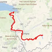
Distance
⨦ 175.5 km
Flat equivalent
Uphill
+ 11 400 m
Downhill
- 13 350 m
Location
Hérémence, Schweiz/Suisse/Svizzera/Svizra
Time predictions
Check your potential! Estimate your finish time, see if you can run the course in a certain time, or maybe you'll compete for the win?
Check nowElevation profile
Highest point
2 982 m a.s.l.
Lowest point
370 m a.s.l.
Elevation range
2 612 m
Mont Brûlé ~ 2 572 m a.s.l.
⨦ 35.5 km
Mont de l'Arpille ~ 2 085 m a.s.l.
⨦ 71.5 km
Sé Blanc ~ 1 729 m a.s.l.
⨦ 109 km
Croix d'Incrène ~ 1 839 m a.s.l.
⨦ 110 km
Pointe des Ombrieux ~ 1 981 m a.s.l.
⨦ 137 km
Tour de Don ~ 1 998 m a.s.l.
⨦ 138 km
Crête de Chaux Longe ~ 1 882 m a.s.l.
⨦ 139 km
Tête du Tronchey ~ 1 913 m a.s.l.
⨦ 139.5 km
Distance above 2 000 m a.s.l.
⨦ 38.5 km
Course information
Elevation data
Copernicus DEM 30 m
Number of events with this course
2
Event date
25 Aug 2026
Course statistics
Join to discover more!
Check your run history, analyze your achievements, and compare results with other runners.
Log in nowCourse variant code V-180 – this code is used to group course records in this event.

Your effort has a color
Amator
Beginner Level
Advanced Level
Expert Level
Elite
Rate My Trail © 2018 / 2026
Mountain Runners Ranking